We have compiled a list of manufacturers, distributors, product information, reference prices, and rankings for Surveying System.
ipros is IPROS GMS IPROS One of the largest technical database sites in Japan that collects information on.

Surveying System Product List and Ranking from 11 Manufacturers, Suppliers and Companies | IPROS GMS

Last Updated: Aggregation Period:Jul 15, 2026~Aug 11, 2026
This ranking is based on the number of page views on our site.

Surveying System Manufacturer, Suppliers and Company Rankings

Last Updated: Aggregation Period:Jul 15, 2026~Aug 11, 2026
This ranking is based on the number of page views on our site.

  1. Kyoritsu Electric Corporation Shizuoka//Industrial Electrical Equipment
  2. 晃洋設計測量 Tochigi//others
  3. アイサンテクノロジー Aichi//software
  4. 4 TI アサヒ 本社 Saitama//Industrial Electrical Equipment
  5. 5 ビィーシステム Hokkaido//software

Surveying System Product ranking

Last Updated: Aggregation Period:Jul 15, 2026~Aug 11, 2026
This ranking is based on the number of page views on our site.

  1. Excavation Management System / Automatic Measurement System <Excavation Management / Linear Management> Kyoritsu Electric Corporation
  2. Mountain Forest Surveying System "Yamamori GPS" 晃洋設計測量
  3. Measurement System "WingNeo INFINITY Electronic Flat Panel" アイサンテクノロジー
  4. [PENTAX UAV Laser Surveying System] TI アサヒ 本社
  5. 4 UAV Laser Surveying System UL-3 TI アサヒ 本社

Surveying System Product List

1~26 item / All 26 items

Displayed results

Measurement System "WingNeo INFINITY"

In the office, surveying CAD; on-site, electronic leveling plate/PocketNeo. A surveying system that serves three functions in one device.

"WingNeo INFINITY" is a system that quickly incorporates the necessary technologies and quality standards for surveying, design, and registration work into software, emphasizing the flow of information obtained from fieldwork and received data. It promptly adapts to the latest OS and hardware environments, contributing with proposals that allow for operations to be conducted in a secure environment. The system manages licenses through a network, supports single-use, and systematizes the carrying in and out of data/licenses to and from the field, creating an environment where objectives can be achieved flexibly and at low cost. 【Features】 ■ Contributes to daily operations and cost reduction ■ Quickly adapts to the latest OS and hardware environments ■ "Basic Surveying System" that enables quick and high-quality surveying and registration results ■ "Cadastral Surveying System" focused on ease of use *For more details, please refer to the PDF materials or feel free to contact us.

  • Other measurement, recording and measuring instruments
  • 3D measuring device
  • Surveying System

Added to bookmarks

Bookmarks list

Bookmark has been removed

Bookmarks list

You can't add any more bookmarks

By registering as a member, you can increase the number of bookmarks you can save and organize them with labels.

Free membership registration

Measurement System "WingNeo INFINITY Electronic Flat Panel"

The surveying system, which was only active as a calculation/CAD system in the office, is now operational on-site!

The "WingNeo INFINITY Electronic Tablet" reduces the time required to learn the operations of both the electronic tablet used on-site and the "WingNeo INFINITY" used in the office, as well as the time involved in data transfer and input. It allows you to bring back field notes, calculation tasks, terrain observations/terrain map editing, and cross-sectional observations in a nearly finished form. By collecting data unique to "pen" such as quick notes and sketches, it ultimately enables interpolation into a completed form to be finalized in the office. 【Features】 ■ Reduces time involved in data transfer and input ■ Enables interpolation into a completed form to be finalized in the office ■ Equipped with a measurement button on the longitudinal field notebook ■ Equipped with measurement functions on the cross-sectional field notebook *For more details, please refer to the PDF document or feel free to contact us.

  • Other measurement, recording and measuring instruments
  • Surveying System

Added to bookmarks

Bookmarks list

Bookmark has been removed

Bookmarks list

You can't add any more bookmarks

By registering as a member, you can increase the number of bookmarks you can save and organize them with labels.

Free membership registration

[PENTAX UAV Laser Surveying System]

Measured in a pasture of about 7 hectares! A demonstration was conducted with a flight time of approximately 13 to 14 minutes.

Through our distributor, Asahikawa System Service Co., Ltd., we received a request for a demonstration of the UAV and laser surveying system 'UL-1' from Sun Technical Consultant Co., Ltd. in Abashiri City, Hokkaido. (The current model is UL-3.) Measurements were taken in a pasture of over 7 hectares near Kushiro City, Hokkaido, and the measurement was completed in approximately 13 to 14 minutes of flight time. Additionally, measurements were also conducted using a ground-based 3D laser scanner. For more details, please contact us. *For more information, please refer to the PDF document or feel free to contact us.*

  • Other measurement, recording and measuring instruments
  • Distance measuring device
  • Surveying System

Added to bookmarks

Bookmarks list

Bookmark has been removed

Bookmarks list

You can't add any more bookmarks

By registering as a member, you can increase the number of bookmarks you can save and organize them with labels.

Free membership registration

UAV Laser Surveying System UL-3

Acquire 3D data of a wide area of the surface in a short time, suitable for shortening construction periods and reducing manpower!

The UAV laser surveying system "UL-3," developed by TI Asahi, known for its PENTAX brand surveying instruments. The maximum flight time is approximately 30 minutes (during hovering). Point clouds obtained by the LiDAR sensor are colorized using three 26 MP cameras. In forested areas, the laser reaches the ground surface, allowing for the acquisition of 3D surface data through software processing. It is suitable for obtaining surface data in extensive forest areas and for measuring in hard-to-access disaster sites. The multifunctional software (LP360Drone) is intuitive and easy to process. ■ Maximum flight time: approximately 30 minutes (during hovering / with measurement unit mounted) ■ Equipped with high-rate GNSS/IMU sensors ■ Aircraft model: Matrice350 • Maximum measurement distance of the LiDAR sensor: Max. 300m at 100% reflectivity, 120m at 20% reflectivity • FOV 120° (horizontal) 40.3° (forward) • Improved vegetation capture with three echoes • Equipped with high-precision IMU • Sensor status can be monitored via WebUI • Weight of the LiDAR unit is approximately 2.23kg • Aircraft model: DJI Matrice350 • Communication range is approximately 8km

  • 3D measuring device
  • Surveying System

Added to bookmarks

Bookmarks list

Bookmark has been removed

Bookmarks list

You can't add any more bookmarks

By registering as a member, you can increase the number of bookmarks you can save and organize them with labels.

Free membership registration

Mountain Forest Surveying System "Yamamori Compass"

Compass surveying on Android devices! Easy operation with the ability to display Geospatial Information Authority maps as background images.

Kōyō Design Survey Co., Ltd.'s "Yamamori Compass" is a forest surveying system that allows compass surveying on Android devices. It significantly reduces surveying time, and the surveying data is provided with coordinates. Area, extension, and closure ratio can be confirmed on-site, and the area and extension for each division are displayed. It is easy to operate without a manual, as it allows the display of the Geospatial Information Authority of Japan map as a background. 【Features】 ■Significantly reduces surveying time ■On-site confirmation of area, extension, and closure ratio ■Displays area and extension for each division ■Ability to display the Geospatial Information Authority of Japan map as a background ■Easy operation without a manual *For more details, please refer to the PDF materials or feel free to contact us.

  • Other network tools
  • Communications
  • Other measurement, recording and measuring instruments
  • Surveying System

Added to bookmarks

Bookmarks list

Bookmark has been removed

Bookmarks list

You can't add any more bookmarks

By registering as a member, you can increase the number of bookmarks you can save and organize them with labels.

Free membership registration

Mountain Forest Surveying System "Yamamori GPS"

High-precision GNSS receiver measurement system

Yamamori GPS is an Android software for GPS surveying. It enables high-precision surveying when combined with an external dual-frequency RTK-GNSS receiver. You can verify extensions and areas on the device based on the observed results. Since it can display data such as forest compartment and land number on the background map, it can also be used for confirming your current location and conducting field surveys. Additionally, the observation results can be used to create drawings and field notebooks that comply with afforestation assistance projects through a separate drawing application. *For more details, please refer to the PDF materials or feel free to contact us.*

  • Other network tools
  • Communications
  • Other measurement, recording and measuring instruments
  • Surveying System

Added to bookmarks

Bookmarks list

Bookmark has been removed

Bookmarks list

You can't add any more bookmarks

By registering as a member, you can increase the number of bookmarks you can save and organize them with labels.

Free membership registration

Excavation Management System / Automatic Measurement System <Excavation Management / Linear Management>

Display current and past values, along with all collected data on the screen! It is possible to save in CSV format.

The "Excavation Management System and Automatic Measurement System" is a system that manages the excavation status and position of the shield machine in real time. Equipped with comprehensive excavation management features, it saves time-series data and measurement data every 10 mm of excavation stroke in a database. Additionally, it achieves high-precision position management using the Javel system/total station system. 【Features】 <Comprehensive Excavation Management Functions> ■ Daily excavation reports, including ring reports and daily reports, can be automatically created and printed. ■ Email distribution function allows easy confirmation of day/night shift progress and soil pressure values on holidays. <Accurate Machine Position Calculation and Automatic Measurement Functions> ■ Real-time calculation and display of position information and machine posture. ■ Provides numerous effective functions for quality management, including machine measurement. *For more details, please refer to the PDF materials or feel free to contact us.

  • 11-2.png
  • 11-3.png
  • 11-4.png
  • 11-5.png
  • Other measurement, recording and measuring instruments
  • Surveying System

Added to bookmarks

Bookmarks list

Bookmark has been removed

Bookmarks list

You can't add any more bookmarks

By registering as a member, you can increase the number of bookmarks you can save and organize them with labels.

Free membership registration

Non-GCP UAV Photogrammetry

Surveying with Drones: No GCP (Ground Control Points) Needed! Achieving High-Precision 3D Topographic Mapping with UAV Photogrammetry.

"Non-GCP UAV Photogrammetry" enables the creation of high-precision 3D topographic maps even when GCPs (Ground Control Points) or reference points cannot be established. In addition to UAV flight control, it is equipped with the αUAV-mounted dual-frequency synchronized imaging system "GCSv3." This system allows for the assignment of high-precision position and elevation data to each digital photo taken. It enables the creation of accurate drawings even in situations where on-site work by personnel is difficult, such as during disasters. 【Features】 ■ No need to ensure the visibility of existing reference points, eliminating the need for activities like deforestation. ■ Reduces the time and effort required to establish ground reference points. ■ The captured photos and GNSS measurement values are accurately determined through synchronization. ■ The synchronization function significantly streamlines the establishment of ground references. For more details, please refer to the catalog or feel free to contact us.

  • Contract measurement
  • Surveying System

Added to bookmarks

Bookmarks list

Bookmark has been removed

Bookmarks list

You can't add any more bookmarks

By registering as a member, you can increase the number of bookmarks you can save and organize them with labels.

Free membership registration

Forest Measurement System "Assist8"

Strongly supports the elements necessary for forest maintenance management and operations! A forest surveying software that combines mixed processing of GPS and compass surveying with information management functions.

"Assist8" is a forest surveying software that supports the enhancement of elements necessary for the maintenance and management of forests. With simple operations using graphics, it displays basic maps over wide areas. It combines mixed processing of GPS and compass surveying with information management functions, fully supporting the centralized management, processing, and output of surveying data. 【Features】 ■ Various printing formats ■ Equipped with information management functions ■ Location management with public coordinates ■ Compatible with aerial photographs ■ Possible to link with databases (optional) *For more details, please refer to the PDF materials or feel free to contact us.

  • Other CAD
  • Data Search Software
  • Surveying System

Added to bookmarks

Bookmarks list

Bookmark has been removed

Bookmarks list

You can't add any more bookmarks

By registering as a member, you can increase the number of bookmarks you can save and organize them with labels.

Free membership registration

[Subsidy-eligible product] UAV and laser surveying system 'UL-1'

Workflow using on-site and computer! It determines accurate position and posture even in windy conditions.

The "UL-1" is a UAV and laser surveying system capable of high-precision three-dimensional modeling of numerical terrain models and large-scale numerical topographic maps. Laser surveying and aerial photogrammetry are complemented by synchronization/hybridization through IMU. Aerial photogrammetry for map creation is easily realized with UAVs. It demonstrates cost performance in mapping areas that include urban and forested regions. It is equipped with a long-range scanner and a full-size sensor DSLR camera. 【Features】 ■ High-rate GNSS/IMU sensors ensure precise position and orientation ■ Scanning width of 300m from a ground height of 150m ■ Workflow between the field and computer ■ Significant reduction in the number of GCPs ■ Built-in DSLR camera with a full-size sensor *For more details, please refer to the catalog or PDF materials, or feel free to contact us. ★ This product is a surveying instrument that can utilize "subsidy support" upon purchase. It may be available for purchase at 1/2 to 1/3 of the regular price! If you are interested, please do not hesitate to contact us.

  • others
  • Surveying System

Added to bookmarks

Bookmarks list

Bookmark has been removed

Bookmarks list

You can't add any more bookmarks

By registering as a member, you can increase the number of bookmarks you can save and organize them with labels.

Free membership registration

[Subsidy-eligible product] UAV and laser surveying system 'UL-2'

Acquire realistic 3D colored point clouds with built-in long-range scanner.

The "UL-2" is a UAV and laser surveying system capable of high-precision three-dimensional modeling of numerical terrain models and large-scale numerical topographic maps. 【Features】 ■ Total weight: lightweight and compact at 9kg (including measurement unit approximately 2.7kg) ■ Flight time: approximately 27 minutes (during hovering) ■ Multi-echo compatible high-precision laser equipped ■ High-rate GNSS/IMU equipped: calculates position and orientation with high precision ■ Camera: 12.3 million pixels ■ Airframe: DJI Matrice 300 ■ Controller with operation panel (no tablet required) ■ Communication range: approximately 8km (domestic) ■ Equipped with six-direction obstacle sensors. The folding structure allows for easy assembly when stored. The main battery consists of two units that can be hot-swapped. *For more details, please refer to the catalog or PDF materials, or feel free to contact us. ★ This product is a surveying instrument that can utilize "subsidy support" at the time of purchase. It may be available for purchase at 1/2 to 1/3 of the regular price! If you are interested, please do not hesitate to contact us.

  • others
  • Surveying System

Added to bookmarks

Bookmarks list

Bookmark has been removed

Bookmarks list

You can't add any more bookmarks

By registering as a member, you can increase the number of bookmarks you can save and organize them with labels.

Free membership registration

Efficient output of accurate 3D point clouds and photos [Vehicle-mounted photo laser measurement]

Equipped with GPS, optical cameras, and various measuring instruments, continuously measuring while on the move!

"Vehicle-mounted Photogrammetry Laser Measurement (MMS)" is a system that carries measurement instruments such as laser scanners, GPS, IMU, and optical cameras on a vehicle to continuously measure while in motion. By expanding the data obtained from each measurement instrument into the same coordinate space, it efficiently outputs accurate 3D point clouds and images. Calibration technology, which is used to maintain the accuracy of this composite system, is a feature of this system. 【Features】 ■ Acquires location information via GPS ■ Captures situations with a camera ■ Obtains 3D data using a laser scanner ■ Collects tilt and other data with an IMU and maintains GPS accuracy ■ Acquires 2 million points of point cloud per second *For more details, please refer to the PDF document or feel free to contact us.

  • Other electronic measuring instruments
  • Other measurement, recording and measuring instruments
  • Surveying System

Added to bookmarks

Bookmarks list

Bookmark has been removed

Bookmarks list

You can't add any more bookmarks

By registering as a member, you can increase the number of bookmarks you can save and organize them with labels.

Free membership registration

Depth Measurement System 'SBES Lead & Analysis'

Make depth measurement operations simple, reliable, efficient, and accessible! Simple and easy-to-understand operability.

The "SBES Lead & Analysis" is a depth measurement system composed of SBES Lead software, which captures and guides single-element depth sounder data according to the survey line plan, and SBES Analysis, which cleans the recorded data and creates various output charts and calculation logs. In the data recording and navigation tool Lead, we provide the creation of planned survey lines and navigation functions based on those lines. It also supports the reading of DXF/DWG data for background display of the shoreline and other features. 【Features】 ■ Captures single-element depth sounder data according to the survey line plan ■ Simple and easy-to-understand operability ■ Makes depth measurement work simple, reliable, efficient, and accessible ■ Lead supports reading and displaying DXF/DWG files as background ■ Analysis supports output of various results *For more details, please refer to the PDF materials or feel free to contact us.

  • Software (middle, driver, security, etc.)
  • Surveying System

Added to bookmarks

Bookmarks list

Bookmark has been removed

Bookmarks list

You can't add any more bookmarks

By registering as a member, you can increase the number of bookmarks you can save and organize them with labels.

Free membership registration

Measurement System "WingNeo INFINITY Paper Drawing Utilization"

Combining large amounts of public map data is easy and simple! Also for tracing work.

"WingNeo INFINITY Paper Drawing Utilization" is a surveying system that allows for easy operation and the seamless merging of large amounts of public map data. By simply setting the initial position of the drawing frame within the raster, it can perform OCR character recognition of the drawing frame coordinates, enabling fast processing of trimming and alignment for use in continuous transcriptions of public maps, etc. Additionally, it can extract point names, XY coordinates, and elevation values through character recognition from various tables present in the raster drawings (such as permanent feature tables, coordinate lists, area calculation tables, reference point tables, etc.), and transfer them as coordinate data or parcel data for use on-site. 【Features】 ■ Automatic merging of public maps ■ Effective utilization of registration information provision services ■ Drawing OCR ■ Table reading OCR ■ Summary document OCR *For more details, please refer to the PDF materials or feel free to contact us.

  • Other measurement, recording and measuring instruments
  • 3D measuring device
  • Surveying System

Added to bookmarks

Bookmarks list

Bookmark has been removed

Bookmarks list

You can't add any more bookmarks

By registering as a member, you can increase the number of bookmarks you can save and organize them with labels.

Free membership registration

Measurement System "WingField-GT"

Perfect for land surveying! Information gathering and progress of field investigations are clear at a glance!

"WingField-GT" is a product that supports information collection with handwritten characters, boasting a recognition rate of 99% when entering arbitrary data, by creating a database of survey items and content, allowing for the collection of survey information through selection operations. You can easily start surveys from a blank state against a backdrop of raster maps or web maps from the Geospatial Information Authority of Japan, with GPS, electronic orientation, and an onboard camera facilitating smooth operations. 【Features】 ■ Color-coded pins to indicate progress in information input ■ Awareness of background location and your own position and orientation ■ Capturing field surveys from multiple perspectives through interconnectivity ■ Automatic drawing of boundary lines and land lot names within photos *For more details, please refer to the PDF materials or feel free to contact us.

  • Other measurement, recording and measuring instruments
  • Surveying System

Added to bookmarks

Bookmarks list

Bookmark has been removed

Bookmarks list

You can't add any more bookmarks

By registering as a member, you can increase the number of bookmarks you can save and organize them with labels.

Free membership registration

[Example] UAV Laser Surveying i-construction Initial Survey

We will introduce examples of UAV and laser surveying using PENTAX's dual-frequency GNSS receivers!

We would like to introduce a case study of i-construction site surveying from our client, Michibata Corporation in Fukui City. Michibata Corporation is actively engaged in ICT-utilized construction (i-Construction) commissioned by the Ministry of Land, Infrastructure, Transport and Tourism. They handle everything from creating 3D design data, aerial surveying using UAVs, point cloud processing, to 3D as-built management. You can find more details in the related links below, so please take a look. *For more information, please refer to the PDF document or feel free to contact us.

  • Other measurement, recording and measuring instruments
  • Surveying System

Added to bookmarks

Bookmarks list

Bookmark has been removed

Bookmarks list

You can't add any more bookmarks

By registering as a member, you can increase the number of bookmarks you can save and organize them with labels.

Free membership registration

3D Measurement System 【3D-Field】

For one-man surveying! Surveying is possible with intuitive operation through the integration of real and virtual.

"3D-Field" is a three-dimensional surveying system that displays data in 3D and enables intuitive surveying operations by linking real-world movements with movements within the device. It can create existing structures and also convert BIM and CIM data into 3D. By using an automatic tracking total station, basic surveying tasks such as "positioning" and "surface management with TIN" can be performed by a single person. 【Features】 ■ One-man surveying ■ Freely create sites with 3D data ■ Surface management with TIN ■ Compatible with a wide range of surveying instruments *For more details, please refer to the PDF materials or feel free to contact us.

  • 3D measuring device
  • Surveying System

Added to bookmarks

Bookmarks list

Bookmark has been removed

Bookmarks list

You can't add any more bookmarks

By registering as a member, you can increase the number of bookmarks you can save and organize them with labels.

Free membership registration

GPS/GIS Surveying System 'ARUQ Android'

Observation is as simple as stopping and pressing a button! An Android app that supports GIS data collection, surveys, outline measurements, and navigation.

The GPS/GIS surveying system 'ARUQ' has now been newly released in an Android version. Based on the existing features that have received positive feedback, it leverages the characteristics of the Android OS, allowing all functions to be operated with just your fingers. We provide ARUQ, which supports easy operation for GIS data collection, surveys, preliminary measurements, and navigation, all with a smartphone-like experience. 【Features】 ■ Can be operated by one person ■ Operable with just fingers ■ Public coordinate management via GPS ■ Observations can be made by simply stopping and pressing a button ■ Background map display *For more details, please refer to the PDF document or feel free to contact us.

  • Other information systems
  • Surveying System

Added to bookmarks

Bookmarks list

Bookmark has been removed

Bookmarks list

You can't add any more bookmarks

By registering as a member, you can increase the number of bookmarks you can save and organize them with labels.

Free membership registration

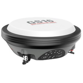
GNSS:『Leica Viva GS16』

Lightweight GNSS Smart Antenna for Accurate Positioning

The GS16, which has high reliability, is a product for surveyors who need a GNSS surveying system that adapts to surveying sites. It is lightweight, making it portable anywhere, and can measure even in harsh and difficult field environments. *For more details, please refer to the catalog or PDF materials, or feel free to contact us.*

  • others
  • Surveying System

Added to bookmarks

Bookmarks list

Bookmark has been removed

Bookmarks list

You can't add any more bookmarks

By registering as a member, you can increase the number of bookmarks you can save and organize them with labels.

Free membership registration

[Subsidy-eligible product] UAV and laser surveying system 'UL-3'

Acquire 3D data of a wide area of the surface in a short time. Suitable for shortening construction periods and reducing labor.

The "UL-3" is a UAV and laser surveying system capable of high-precision three-dimensional modeling of numerical terrain models and large-scale numerical topographic maps. 【Features】 ■ LiDAR sensor with a point cloud density of 640,000 points/360° ■ Maximum measurement distance of 300 meters, suitable for measuring forest areas and disaster sites ■ Equipped with high-rate GNSS/IMU sensors and the Matrice 350 airframe ■ Maximum flight time of 30 minutes (during hovering) with a communication range of approximately 8 km ■ The area that can be measured on a single full charge is 458m x 458m = approximately 21 hectares (equivalent to about 4.5 Tokyo Domes). ■ The intuitive software "LP360" allows for the generation of deliverables and classification of point clouds. *For more details, please refer to the catalog or PDF materials, or feel free to contact us. ★ This product is a surveying instrument that can utilize "subsidy funding" upon purchase. It may be possible to purchase at a price of 1/2 to 1/3 of the regular price! If you are interested, please do not hesitate to contact us.

  • others
  • Surveying System

Added to bookmarks

Bookmarks list

Bookmark has been removed

Bookmarks list

You can't add any more bookmarks

By registering as a member, you can increase the number of bookmarks you can save and organize them with labels.

Free membership registration

RIN measurement system "A0010A"

It reduces the uncertainty of noise analysis and achieves high measurement reproducibility.

The A0010A RIN measurement system provides wideband RIN measurement up to 50 GHz. By measuring RIN across various wavelengths and frequency ranges, it enables the understanding of various characteristics of laser diodes, such as noise and bandwidth, allowing for the acquisition of important design and quality indicators, as well as promoting product differentiation. Additionally, by integrating with the A0020A laser linewidth measurement system and the A0040A optical noise analyzer, efficient system operation can be achieved. 【Features】 ■ Provides wideband RIN measurement up to 50 GHz ■ Compatible with wavelengths from 780 nm to 1625 nm ■ Optical modulation measurement function can also be added *For more details, please download the PDF or feel free to contact us.

  • Optical Measuring Instruments
  • Surveying System

Added to bookmarks

Bookmarks list

Bookmark has been removed

Bookmarks list

You can't add any more bookmarks

By registering as a member, you can increase the number of bookmarks you can save and organize them with labels.

Free membership registration

UAV laser surveying system 'UL-3' effective for shortening construction periods and reducing manpower.

Acquire 3D data of a wide area of the surface in a short time. Ideal for shortening construction time and reducing labor!

The 'UL-3', developed by TI Asahi, known for its PENTAX brand surveying equipment, is a UAV laser surveying system capable of acquiring high-precision 3D data of extensive surface areas using a LiDAR sensor and three 26 MP cameras. It can fly for up to 30 minutes, making it particularly suitable for measuring forest areas and disaster sites. The measurement range is up to 300 meters. It employs a high-rate GNSS/IMU sensor and the Matrice 350 airframe. The included LP360Drone software makes it easy to create deliverables, effectively shortening project timelines and reducing manpower. 【Features】 ■ LiDAR sensor with a point cloud density of 640,000 points/360° ■ Maximum measurement range of 300 meters, suitable for forest areas and disaster sites ■ Equipped with high-rate GNSS/IMU sensor and Matrice 350 airframe ■ Maximum flight time of 30 minutes (during hovering) with a communication range of approximately 8 km ■ The area that can be measured on a single full charge is 458m x 458m = approximately 21 hectares (about 4.5 times the size of Tokyo Dome). ■ The intuitive software "LP360" allows for the generation of deliverables and classification of point clouds. *For more details, please download the materials or contact us.

  • others
  • Surveying System

Added to bookmarks

Bookmarks list

Bookmark has been removed

Bookmarks list

You can't add any more bookmarks

By registering as a member, you can increase the number of bookmarks you can save and organize them with labels.

Free membership registration